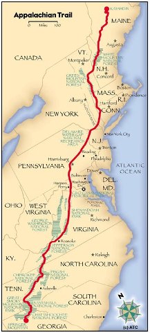
START LOCATION: Davenport Gap Shelter
FINISH LOCATION: Groundhog Creek Shelter
TODAY'S MILEAGE: 10.5
TRIP MILEAGE: 245.6
MILES TO GO: 1,933.5
Upgrade, Cornpatch and I slept in this morning. We didn't get up until
almost 8AM... That's the latest I can remember since Woods Hole on Day
4. Anyway, that was the nicest part of the day. From then on, the day
was just foggy, raw and soupy.
We rolled out just before 10AM and it immediately started raining. Saw
my first wild flowers today along the Pigeon River. I was just in the
snow yesterday! Wild. Got to I-40 just to see it still closed from the
massive rockslide back in October. Cornpatch and I wanted to setup
camp right in the middle of the eastbound lanes for fun and photo ops.
But, it was pouring out. Forget that.
Rolled into Standing Bear Farm, the first hostel out of the Smokies.
Saw Hollywood and Mikey there waiting for a maildrop. We were able to
top off our food bags at their hiker resupply "store". It was an old
12x10 shed with hiker food and gear for sale. It was sketchy...
Especially when one of the Carnation IBs I picked up had been chewed
into by mice. Anyway, got some goodies to tie me over to Hot Springs
where I will meet Tracey, Todd and Katie, my cousins for some R&R. To
TnT, if I can't reach you by phone, let's meet in front of the caboose
in the middle of town at 3pm on April 1. I should be there early in
the day, so if you get there before that, I'll be in the library
uploading pics. Horrible phone service lately!
I digress... The privy at the Standing Bear had a 4 foot long 2x4 arm
that you could lower on the landing to indicate your privy occupancy.
Well, I didn't know it was there and as I walked out of the outhouse
it somehow let go and came crashing down on the top-front of my skull.
I was seeing tweety birds and pixie dust for a few moments. Well, it
put another damper on my day as I had a nasty headache for the
remaining 7 miles and the nearly 3,000' ascent up Snowbird Mountain.
So couple the cold driving rain with a headache and it made today very
forgettable. The summit of Snowbird was probably pretty nice, as it
was a huge bald with some good exposure. But, could barely see 100 ft
in front of me today and almost missed the very interesting FAA air
traffic control installation at the top. It looked very secretive and
futuristic. It had a round disc about 80' in diameter suspended 10
feet in the air with a 50' tall smokestack looking cone protruding up
to the sky. Some type of radar I guess. Pics soon.
Flew down the 1,200 feet to the shelter where we have a packed
house... Even a couple tenters as a result. I think the weather gets
better tomorrow and I'm looking forward to nice views from Max Patch,
a gorgeous sweeping grassy bald overlook.
A little reading before bed tonight. Almost done with Tristan and
Iseult... And yes, he did slay the dragon. Ha.
-natedog

Nate, you'll read this after you've already enjoyed some of it but I checked the forecast, using Asheville for a location, and you are in for sun and warm weather for the next week at least. (So are we after this rains lets up!) Have fun with TT&K. (No B&J?)
ReplyDeleteNo B&J - she has to work. Just us kids! I told Nate to be prepared to color Easter Eggs as the Easter Bunny will have to find Katie in the mountains ; ) He called today and we made our final arrangements for pickup. Looking at 80 and sunny at the cabin for the next 5 days! Gee think we can Nate to take long walks in the woods with us?
ReplyDeleteTracey
Think you could keep up?
ReplyDeleteHope your head feels better! Luke and I have been reading your posts almost everyday, awesome progress :) Hope you have a great Easter!
ReplyDeleteHope you are still not seeing tweety birds and pixie dust ;). You'll have MUCH more reading after you hook up with T! ;p)
ReplyDeleteTalk soon!